Journey Plotter

Home to our madcap crew of digital buccaneers
Check in here for chat, games and entertainment
User avatar
Maikel
Posts: 520
Joined: Sat Mar 21, 2020 9:14 am
Location: The Netherlands
Contact:

Journey Plotter

Post by Maikel »

Journey Plotter

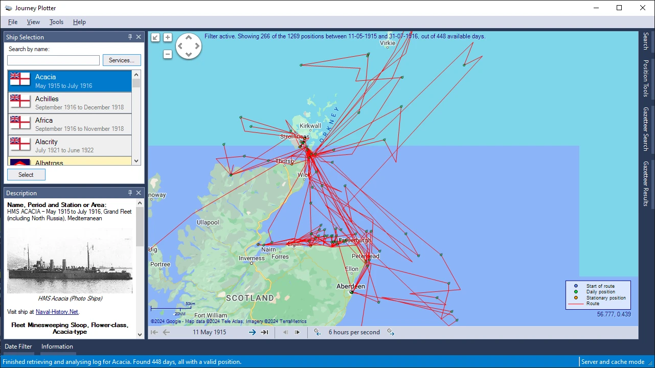
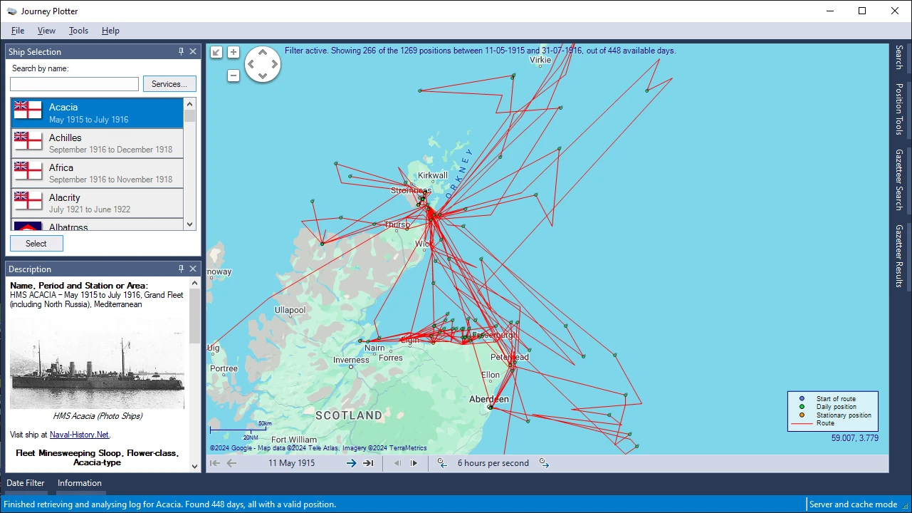
Like probably many of you, I've often wondered what the journey of a Royal Navy ship that I've worked on would look like on a map.

To fulfil my own curiosity I started working on a Windows application that could do just that.
I found it so satisfying that I felt I had to share it with others.
I therefore made Journey Plotter available for free to you, too.

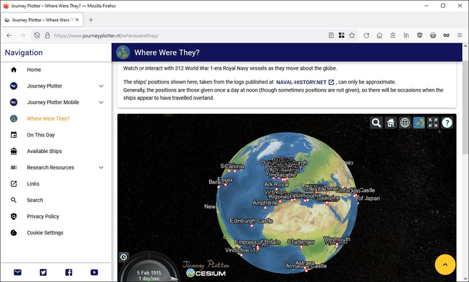
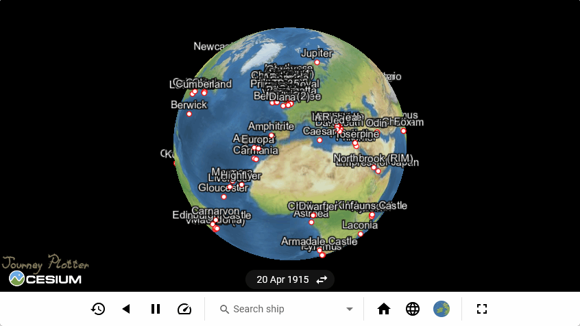
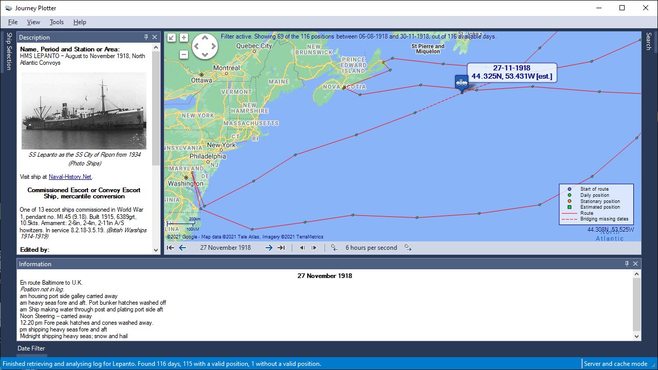
Journey Plotter is a Windows application for visualizing journeys of Royal Navy vessels of the World War 1-era, or Arctic voyages of United States vessels from the mid 19th century onwards.
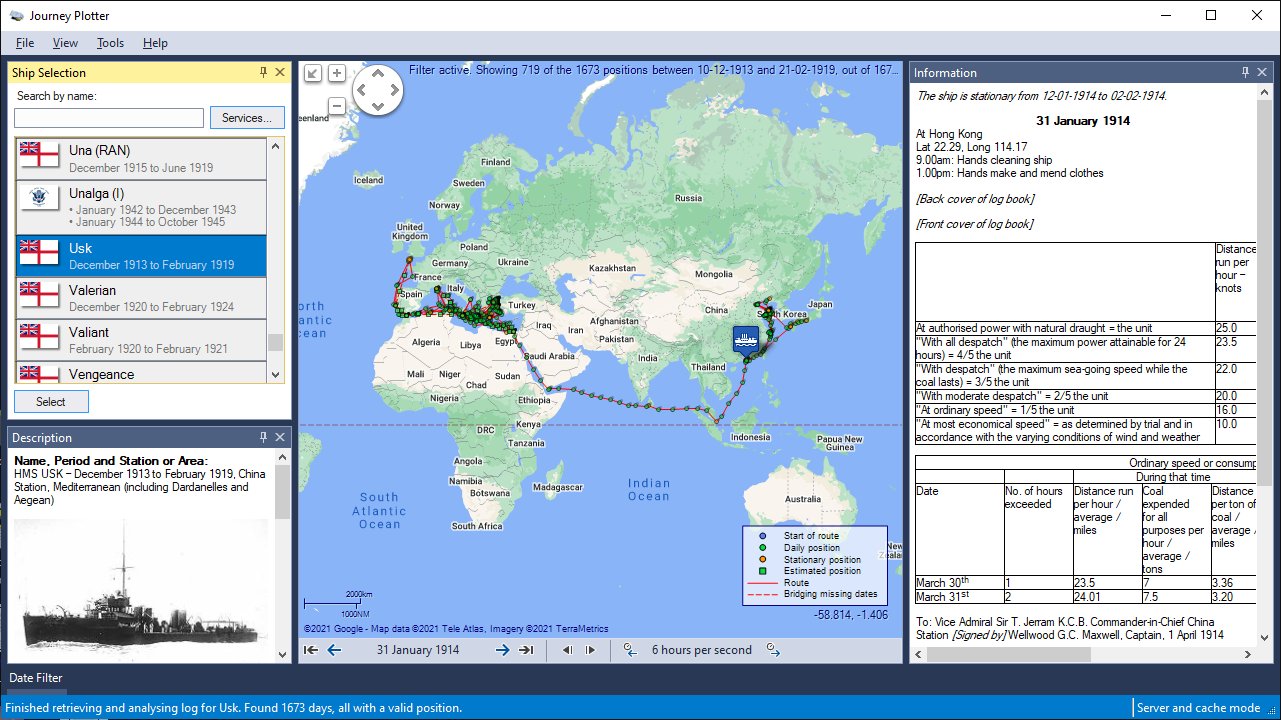
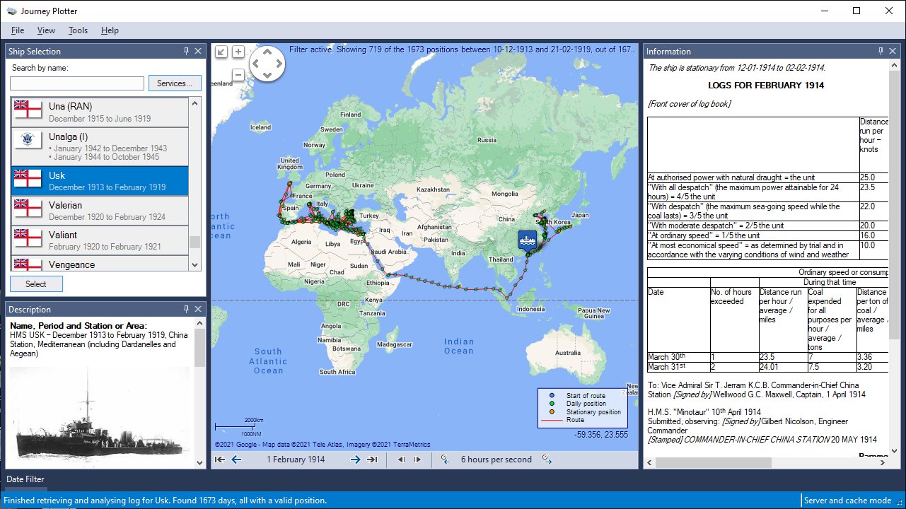
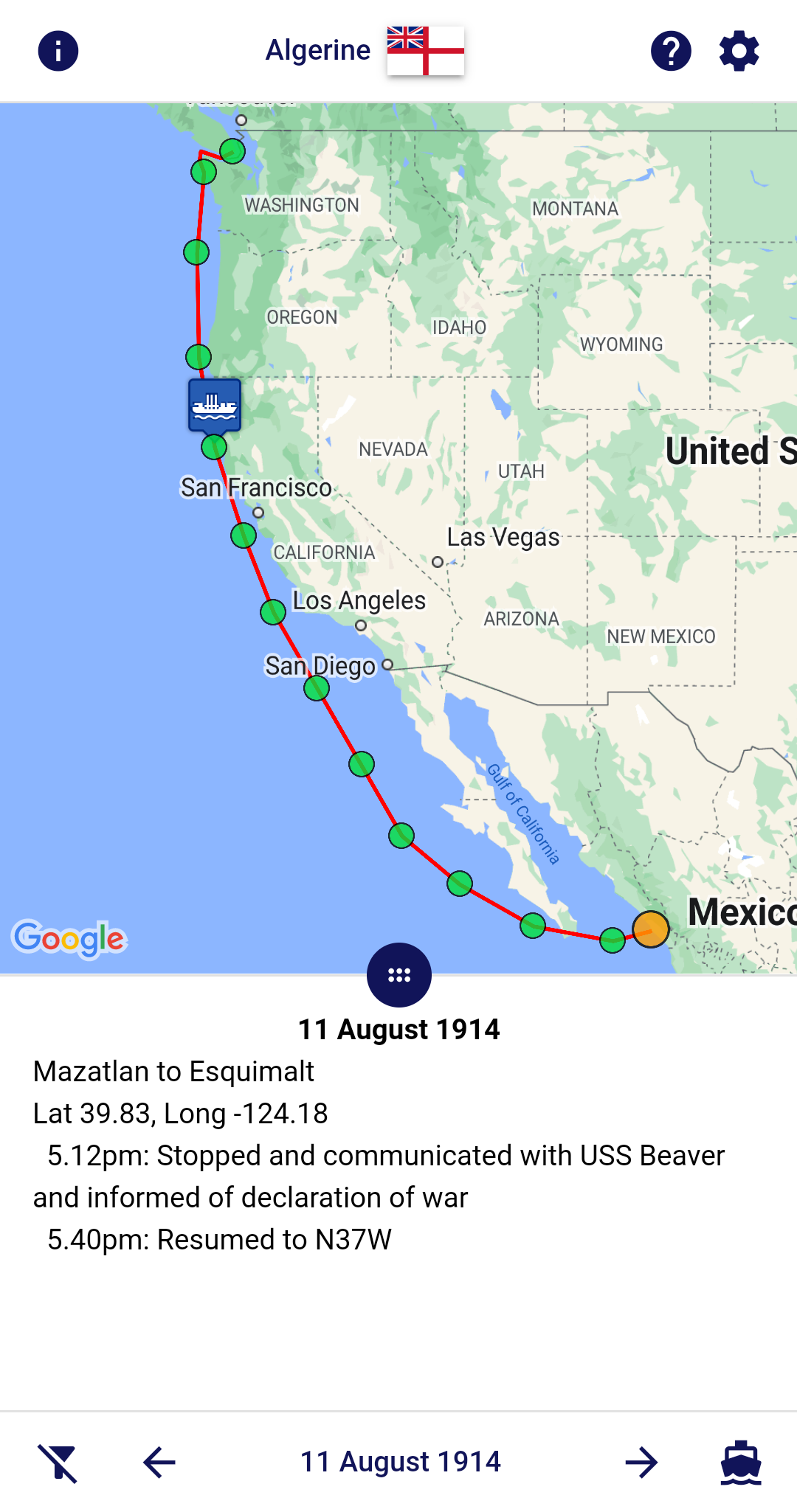
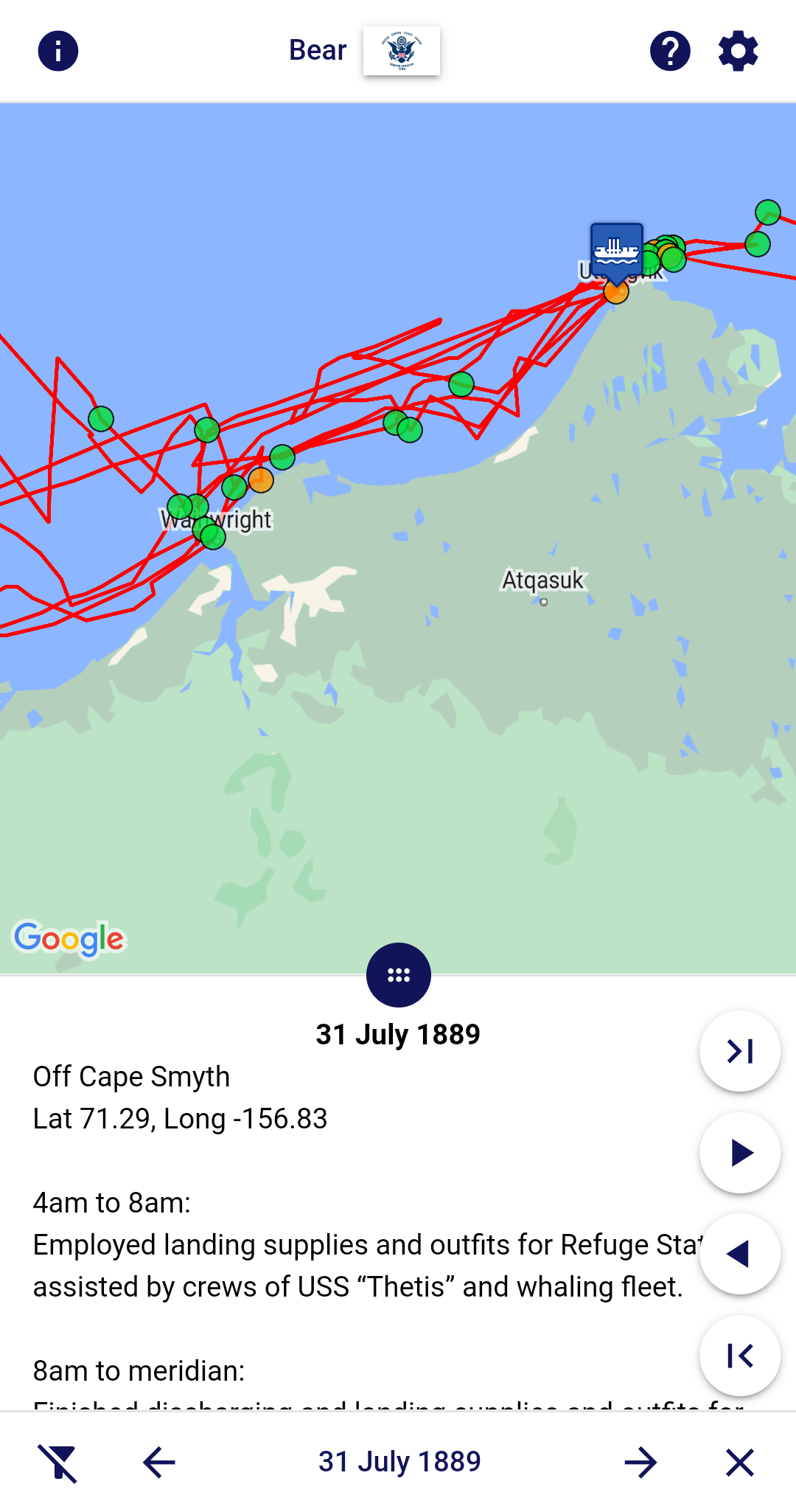
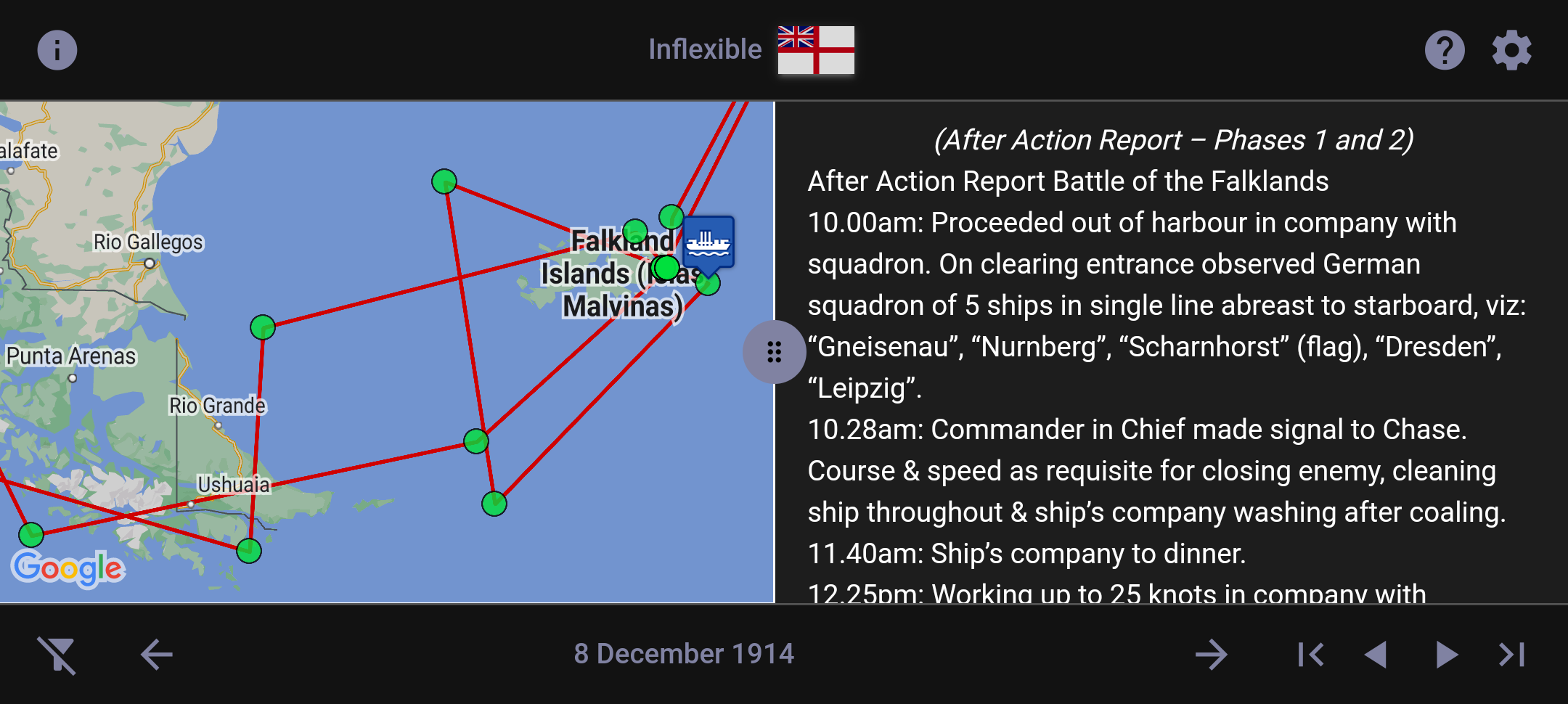
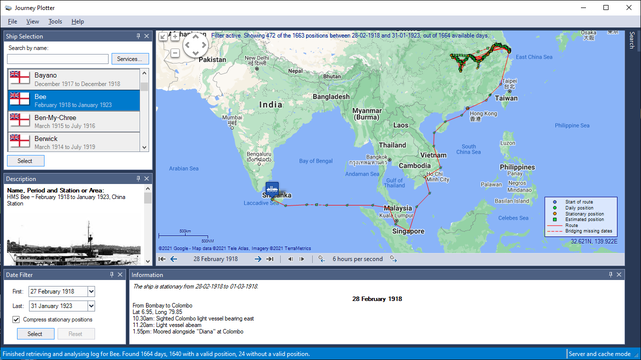
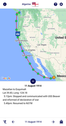
For a given day, you can see the ship's position and read the log-book entries that describe activities on board.

Journey Plotter makes use of data from original Royal Navy and United States log-books that has been digitised and then made available by Naval-History.Net.
The log-books have been transcribed by volunteers on the Old Weather project and edited into a more readable form by volunteers on the Naval-History.Net project.

Journey Plotter allows you to:
  • Run Windows platforms from Windows 7 onward.
  • Customize it's environment, including theming.
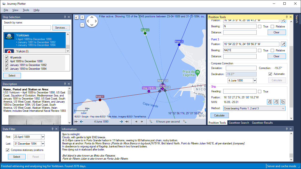
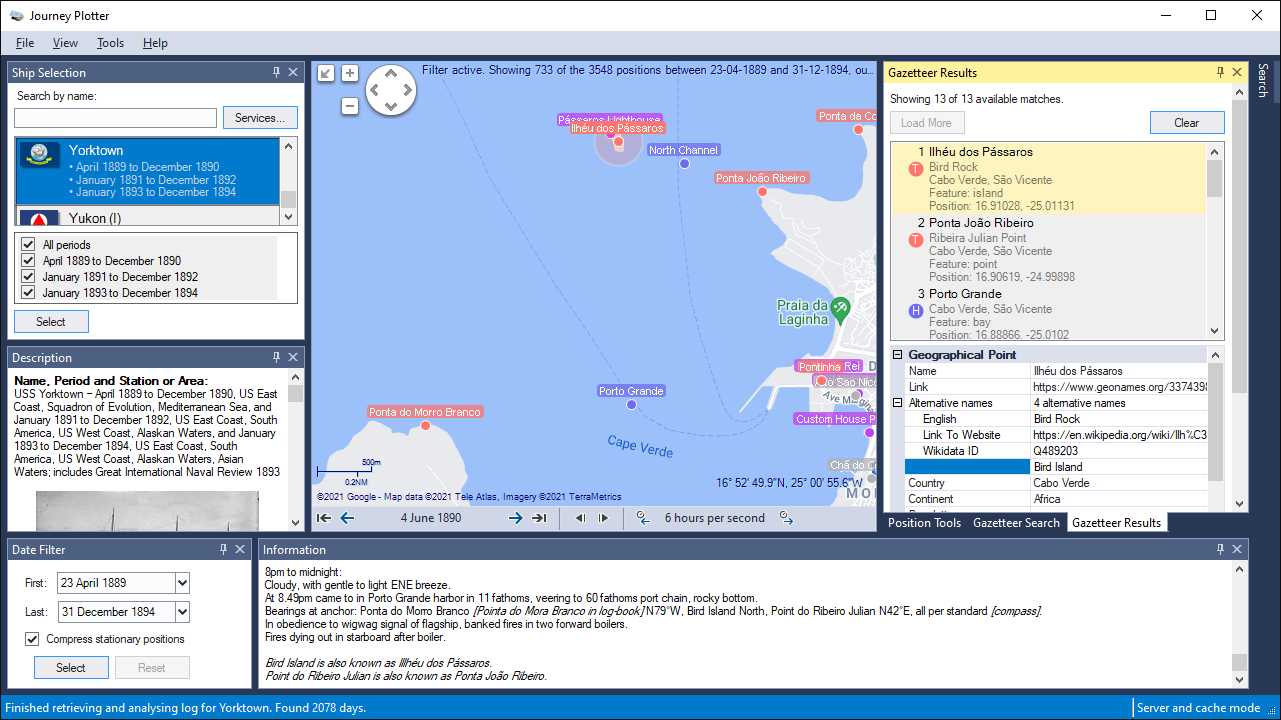
  • Select a ship from Royal Navy WW1-era or United States Arctic ships since mid-19th century.
  • Show information about the selected ship and her log-book editor.
  • Use the map provider of your choice:
    • Google
    • Bing
    • OpenSeaMap
    • OpenStreetMap
  • For most map providers the map, satellite, terrain or hybrid view can be used.
  • Pan and zoom the map.
  • Show a route line.
  • Show position markers. Different markers can be used to indicate gaps in dates and stationary positions.
  • Change the position format.
  • Filter by date.
  • Walk though dates manually, or animate the journey.
  • For a given day, show the log-book entries that describe the ship's activities.
  • Search for text in the ship's logs.
  • Automatically read all parts of multi-part logs.
  • Indicate duplicate dates.
  • Save a map as an image.
  • Use many customizable settings, such as route and marker colours and sizes, animation speed, position format and map provider access mode.
An example:
Image

If you're interested in Journey Plotter follow the link to learn more about it: https://www.journeyplotter.nl/

Journey Plotter can also be followed on Mastodon, Twitter and Facebook.

Edit: added Mastodon link
Last edited by Maikel on Wed May 18, 2022 11:19 am, edited 1 time in total.
User avatar
Maikel
Posts: 520
Joined: Sat Mar 21, 2020 9:14 am
Location: The Netherlands
Contact:

Re: Journey Plotter

Post by Maikel »

Journey Plotter is also available for Android phones and tables: Journey Plotter Mobile.

Image Image

Get Journey Plotter Mobile on Google Play.

If you want to have more information first, visit the Journey Plotter Mobile pages.
Or watch a short video showing some of the features: https://www.youtube.com/embed/GEvO578o7sI

Edit: changed for release of JP-M v2.0.
Last edited by Maikel on Wed Feb 08, 2023 12:50 pm, edited 1 time in total.
User avatar
Maikel
Posts: 520
Joined: Sat Mar 21, 2020 9:14 am
Location: The Netherlands
Contact:

Re: Journey Plotter

Post by Maikel »

Also visit the Journey Plotter website for:

Where Were They?

Ever wanted to know the movements of hundreds of Royal Navy vessels during World War 1?
Watch or interact with all naval-history.net WW1 ships as they move about the globe.

Example:
Image


On This Day

Read a random log-book page for this day from the many ships transcribed by volunteers on the Old Weather project and edited into a more readable form by volunteers on the naval-history.net project.

Example:
Image


Research Resources

The research resources are split into four categories: There's also an extensive list of Abbreviations.
User avatar
Maikel
Posts: 520
Joined: Sat Mar 21, 2020 9:14 am
Location: The Netherlands
Contact:

Re: Journey Plotter

Post by Maikel »

I'm pleased to announce the release of Journey Plotter 2.3.

A new option to estimate the noon position for days without one, improved responsiveness for journeys with many route points, and a number of other small changes and bug fixes.

It's available from the Journey Plotter download page, which also lists the changes in more detail.
https://www.journeyplotter.nl/jp/download.html

Image
User avatar
Maikel
Posts: 520
Joined: Sat Mar 21, 2020 9:14 am
Location: The Netherlands
Contact:

Re: Journey Plotter

Post by Maikel »

Data improvement. 🚢⚓🗺

Until now only changes in date were detected, which meant all information between the start of a log-book and the first actual day were added to the last day of the previous log-book.
These examples show the difference between old and new.

In the old situation 31 January also shows part of the February log-book.
Image

In the new situation it's properly shown at 1 February.
Image
User avatar
Maikel
Posts: 520
Joined: Sat Mar 21, 2020 9:14 am
Location: The Netherlands
Contact:

Re: Journey Plotter

Post by Maikel »

Journey Plotter 2.4 has been released today. 🗺⚓

The new Position Tools assist in calculating the ship's position, and includes a gazetteer to search for geographical points using GeoNames, with many options to fine-tune a search.
The manual describes the Positions Tools in detail: https://www.journeyplotter.nl/jp/manual ... tools.html

Journey Plotter is available from the download page, which also lists all changes in more detail.
https://www.journeyplotter.nl/jp/download.html

Image
Image
User avatar
Maikel
Posts: 520
Joined: Sat Mar 21, 2020 9:14 am
Location: The Netherlands
Contact:

Re: Journey Plotter

Post by Maikel »

Somewhat overwhelmed by all the possibilities the new Position Tools have to offer?
Here's a video showing three examples, taken from a WW1 logbook of HM Torpedo Boat TB.36 and a 1890s logbook of USS Yorktown (PG-1).
It also includes the use of the gazetteer.

https://www.youtube.com/embed/GFsDDVckWig
User avatar
pommystuart
Posts: 1565
Joined: Mon May 18, 2020 12:48 am
Location: Cooranbong, NSW, Australia.

Re: Journey Plotter

Post by pommystuart »

Now, that is a seriously cool bit of coding. :ugeek:
Well done.
I think Michael will love it to death. :P

Microsoft and Trend Micro were not happy with me from running the .exe
(Got there in the end.)
:kangaroo:
User avatar
Maikel
Posts: 520
Joined: Sat Mar 21, 2020 9:14 am
Location: The Netherlands
Contact:

Re: Journey Plotter

Post by Maikel »

Thanks Stuart. 👍
User avatar
AvastMH
Posts: 2675
Joined: Mon Mar 16, 2020 7:48 pm
Location: Oxford, England

Re: Journey Plotter

Post by AvastMH »

Stunning! I am impressed :D
User avatar
Maikel
Posts: 520
Joined: Sat Mar 21, 2020 9:14 am
Location: The Netherlands
Contact:

Re: Journey Plotter

Post by Maikel »

Thanks Joan. 👍
User avatar
Maikel
Posts: 520
Joined: Sat Mar 21, 2020 9:14 am
Location: The Netherlands
Contact:

Re: Journey Plotter

Post by Maikel »

The Journey Plotter website has had an update.
It's now a SPA (Single Page Application), which should give you a much smoother experience.

Not only can you find information about Journey Plotter here, but also Where Were They?, On This Day and research resource pages.

https://www.journeyplotter.nl

Image
User avatar
Maikel
Posts: 520
Joined: Sat Mar 21, 2020 9:14 am
Location: The Netherlands
Contact:

Re: Journey Plotter

Post by Maikel »

Somewhat afraid big tech companies will follow you through social media?
You can now also follow Journey Plotter at Mastodon: a non-profit, decentralized platform, built with a focus on privacy and safety.

https://mastodon.social/@JourneyPlotter
User avatar
AvastMH
Posts: 2675
Joined: Mon Mar 16, 2020 7:48 pm
Location: Oxford, England

Re: Journey Plotter

Post by AvastMH »

Nice one Maikel! :D
User avatar
Maikel
Posts: 520
Joined: Sat Mar 21, 2020 9:14 am
Location: The Netherlands
Contact:

Re: Journey Plotter

Post by Maikel »

I'm pleased to announce the release of Journey Plotter Mobile v2.0.
Main changes:
- Redesigned user interface
- Support for dark theme
- Resizeable map and events panes
- Several performance improvements and small bug fixes

More info: https://www.journeyplotter.nl/jpm/
Or watch a short video showing some of the features: https://www.youtube.com/embed/GEvO578o7sI


Image
User avatar
pommystuart
Posts: 1565
Joined: Mon May 18, 2020 12:48 am
Location: Cooranbong, NSW, Australia.

Re: Journey Plotter

Post by pommystuart »

Hi Maikel.
Have you come across this reference book?
https://www.archives.gov/files/research ... office.pdf

I have no idea how to reference the charts listed.
Thought you might have.
I am doing the Yantic and it is mentioned a few times.
User avatar
Maikel
Posts: 520
Joined: Sat Mar 21, 2020 9:14 am
Location: The Netherlands
Contact:

Re: Journey Plotter

Post by Maikel »

Not sure what this has to do with Journey Plotter, but no, I haven't.
Since it's a catalogue of charts in the National Archives, it's safe to assume you can find them there.
Not necessarily online, though.
User avatar
Maikel
Posts: 520
Joined: Sat Mar 21, 2020 9:14 am
Location: The Netherlands
Contact:

Re: Journey Plotter

Post by Maikel »

Journey Plotter 2.5 has been released today. ⚓🌍

A minor release with some small changes and squashed bugs.

Journey Plotter is available from the download page, which also lists all changes and bug fixes in detail.
https://www.journeyplotter.nl/jp/download
User avatar
Maikel
Posts: 520
Joined: Sat Mar 21, 2020 9:14 am
Location: The Netherlands
Contact:

Re: Journey Plotter

Post by Maikel »

An update to the Where Were They? page.
The interface of the animated globe has been changed to blend in with the rest of the website.

Where Were They?: watch or interact with 313 WW1-era Royal Navy vessels as they move about the globe.

https://www.journeyplotter.nl/wherewerethey

Image
User avatar
Maikel
Posts: 520
Joined: Sat Mar 21, 2020 9:14 am
Location: The Netherlands
Contact:

Re: Journey Plotter

Post by Maikel »

You may have noticed Google Maps in Journey Plotter are no longer uniform in colour.
Sometimes Google changes its map appearance, but Journey Plotter doesn't frequently update its map tile cache.

Clearing the map cache will solve the problem:
- from the Tools menu, select Map Cache...
- in the dialogue click the Clear Disk Cache button
- restart Journey Plotter, the latest maps will then be loaded

More info: https://www.journeyplotter.nl/faq

Image
Journey Plotter showing a mixed coloured map before clearing the map tile cache

Image
Journey Plotter showing a uniformly coloured map after clearing the map tile cache
Post Reply

Return to “Dockside Cafe”